
Katy Neighbors Block Sources
Katy neighbors can be researched only one Katy parcel at a time, with the right county in view. An adjoining Katy polygon is a useful map lead. It does not prove a shared household, friendship, current occupancy, or any other personal relationship. The most dependable Katy public trail moves from a normalized address to the county parcel record, then to an instrument or historical source when a dated ownership question remains. Katy postal city, municipal jurisdiction, and parcel county should be recorded separately.
| Source | What It Shows About a Block | Access |
|---|---|---|
| HCAD Parcel Viewer | Katy Harris parcel polygons, map context, and a clickable account or owner lead | Free map; approximate boundaries and no bulk resident list |
| FBCAD parcel layer | Katy Fort Bend parcel geometry, attributes, and adjacent-parcel context | Public GIS service updated periodically; verify with CAD or clerk |
| Waller CAD map | Katy Waller polygons, property IDs, value, and deed-history leads | Public map and detail path; current tools can change |
| County Clerk instrument index | Katy recorded owner and instrument chain for an adjacent legal parcel | Party, instrument, or legal-description search; copies may have fees |
| Texas voter lookup | Katy registration context for one matching individual | Individual search only, with protected fields withheld |
| Historic directory or newspaper | Dated Katy address occupants, businesses, and public notices | Library or archive access; cite the exact year, title, and page |
A Katy appraisal roll can identify an owner of record, legal description, and tax-year mailing or situs data. It cannot confirm every person who lives at a Katy address. Renters, other occupants, utility customers, delivery data, and private association membership are not a public Katy block list. Keep the difference between owner and occupant visible in every note.
Katy Neighbors County Choice
Katy spans Harris, Fort Bend, and Waller counties. A Katy postal label may point to any of those Katy records systems, and it may also sit outside the incorporated city. That makes Katy county choice the first local question, not an afterthought. Normalize the Katy address through USPS, identify the Katy parcel county in the appropriate CAD, then use the city map or the City’s MUD and jurisdiction information to separate postal city from municipal limits.
The Katy Comprehensive Plan and Katy city mapping material provide dated geographic context, but neither is a title survey or a live ownership register. A Fort Bend court or CAD portal cannot answer a Harris or Waller Katy parcel question. Record the Katy county before using a clerk, court, appraisal district, or elections office. This local three-county decision tree prevents a nearby Katy address from being placed in the wrong records system.
Katy Neighbors Parcel Flow
A Katy block check begins with one known address and stays close to its bordering parcels. The Katy method is not a radius search. No verified buffer tool was captured for the HCAD viewer, so map browse and parcel clicks are the supported Harris method. Fort Bend’s parcel service can be queried by map extent or attributes, and Waller’s public map provides clickable Katy context.
- Normalize the target Katy address, then open HCAD, FBCAD, or Waller CAD for the parcel’s county.
- Find the target Katy parcel by address, owner name, account number, or the map’s own search route. Record its account or parcel identifier and legal description.
- Zoom until adjoining Katy parcel polygons and street labels are clear. Click each adjacent polygon and record only the parcel or account lead.
- Open the CAD detail for each Katy lead. Compare tax year, situs, mailing field, and legal description without treating a mailing address as occupancy.
- When a Katy ownership question remains, follow the correct County Clerk instrument index using the owner role or legal description and verify the dated document.
This process maps the immediate Katy block, not an entire named Katy street. For a street-length Katy address trail, the Katy street directory uses a broader by-address workflow. Adjacent Katy parcels are leads for land records, not proof that the people connected with them form one household or social group.
Katy Neighbors Map Limits
Katy county maps do not have the same tools or update cadence. HCAD’s Parcel Viewer accepts a full or partial Katy address, account number, or owner name, then offers a parcel popup and detail link. Its boundaries are approximate and are not a legal survey. FBCAD provides owner, address, ID, and advanced property-search routes, while its ArcGIS parcel service is periodic data rather than a live record of Katy occupancy. Waller’s map gives clickable Katy parcel context, but the exact layer inventory was not captured.
The FBCAD property-search portal supplies the owner, address, ID, and advanced tabs used after a Fort Bend Katy parcel is identified.
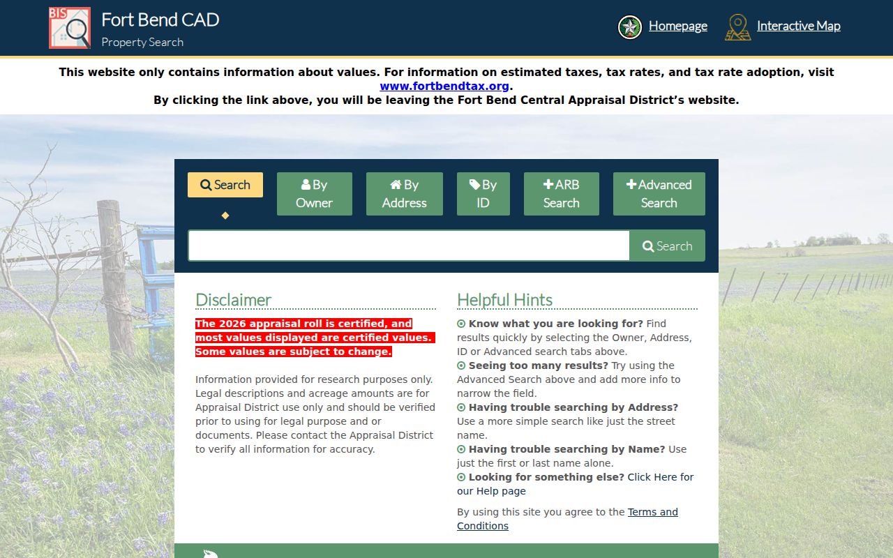
Katy map geometry helps locate an adjacent legal parcel. The CAD detail and, when needed, the recorded instrument provide the dated Katy record trail. Preserve the selected tax year, source date, and approximate-boundary warning when noting a map result.
Note: A city neighborhood label can describe geography, but it does not establish an association membership or a person’s current address.
Katy Neighbors Community Contacts
There is an honest gap in the community-directory layer. The City of Katy confirms that it contains many neighborhoods and master-planned communities, but the official neighborhood page does not publish a household roster or an association directory. No official current Katy HOA umbrella directory, member list, congregation roster, or block-watch roster was located in the research. A neighborhood name is geography, not evidence that someone belongs to a group.
City of Katy Neighborhoods
Use the official page for neighborhood and master-planned-community geography. It does not provide resident or association membership records.
Katy Boards and Commissions
Use appointments and City Secretary agendas for documented civic participation, not as a directory of a neighborhood’s residents.
Katy Heritage Society
Ask about a location, date, object, or historic-family lead through its museum and preservation holdings. Access is contact-mediated.
The Katy Heritage Society is a real local-history contact for documented photographs, objects, and oral-history referrals.

Its holdings can support a historical block question, but no public person-name catalog was located. The Katy Branch library and Fort Bend library resources are also research access points, not attendance or membership records.
Katy Neighbors Voter Rules
Texas My Voter and the Fort Bend voter lookup are individual-query tools. They are not block-browse systems, and they should not be stitched together to make a street roster. The official statewide lookup uses a VUID, an eligible driver-license and date-of-birth path, or a name with county, date of birth, and ZIP. Fort Bend presents VUID, name, and date-of-birth routes, with VUID entered without spaces or dashes.
Public voter data rules still protect key fields. Texas guidance identifies confidential identification and contact information, and protected voters may have a substitute PO box or asterisks in place of a residence address. Do not reconstruct an address from a CAD record, a deed, or a map. A matched voter result can provide current election context for that individual only, and it is not a relationship or occupancy confirmation for nearby Katy neighbors.
Katy Neighbors Deed Context
When parcel data leaves an ownership question open, follow the legal description to the county instrument index. Harris County’s real-property records reach back to 1836, though pre-1961 indexing can require archive or microfilm help. Fort Bend’s online historic library reaches into the 1820s depending on the series, and its index is not address-first. Waller’s exact public Clerk search route was not located, so a Waller CAD detail should not be described as a deed.
Read an official public-record instrument for its grantor, grantee, recording date, document number, legal description, lien, easement, or plat trail. The recorded relationship is between the parties and the parcel. It does not identify present occupants. Fort Bend’s free Property Fraud Alert can monitor documents recorded under an individual, business, or trust name, but it is a protective alert service, not an ownership-search feed.
Katy Neighbor Source Comparison
Official records and commercial neighbor-lookup categories answer different questions. A commercial service can blend parcel, directory, marketing, and court data from mixed dates. That can produce stale, over-inclusive, or wrongly matched results. For a Katy block question, the issuing map, appraisal district, clerk, or city source has a defined custodian, record series, and correction path.
| Source category | Useful for | Limit to remember |
|---|---|---|
| Official parcel, CAD, or clerk record | A dated parcel, owner-of-record, instrument, or jurisdiction fact | Each source is narrow and may be redacted, incomplete, or not current occupancy |
| Official city or community contact | Geography, public civic appointments, programs, or historical holdings | It is not a member roster and may require contact-mediated research |
| Commercial neighbor-lookup category | A starting lead that still requires official confirmation | Mixed sources can be stale, merged, or inaccurate; it cannot override confidentiality |
Use the source’s own correction route if a government record is wrong. A CAD correction goes to the appraisal district, an instrument question goes to the County Clerk, and city-held material goes to the City Secretary’s public-information process.
Katy Neighbors Privacy Limits
Private block facts stay private. Public maps do not publish a list of renters, household members, utility customers, delivery recipients, protected voters, sealed cases, or motor-vehicle addresses. Texas protections can also suppress property and voter fields. The Attorney General’s Address Confidentiality Program provides an eligible safety victim with a substitute mailing address and forwarding service. An address hidden by that program or a protected voter display must never be reverse-engineered.
Use records about Katy neighbors for lawful personal purposes, such as understanding parcel boundaries, resolving a property question with the custodian, reconnecting through an invited public contact, or researching local history. Keep the source, date, and record type with any note. If an official record appears wrong, contact its custodian with the parcel, instrument, case, or account identifier rather than publishing a corrected guess.
Lawful use. Do not use block records to watch, stalk, harass, or intimidate anyone. Stop if a lookup would defeat an address protection, and report threats through official law-enforcement channels.