
Search a Katy Street by Address
A street search begins with the exact Katy physical address, not a mailing-city assumption. Katy reaches Harris, Fort Bend, and Waller counties, so the same Katy postal city can lead to different appraisal districts and clerks. Standardize the Katy address through USPS, keep the house number and directional parts intact, and use the county appraisal search that contains the parcel. The Katy appraisal record supplies an account or property ID, situs address, tax year, legal description, and an owner-of-record lead. That combination makes the next Katy records search more reliable than a street name alone.
- Normalize the Katy address with the USPS ZIP Code Lookup. USPS returns standardized delivery information, but its result does not confirm that a particular person or organization is at the address.
- Use HCAD, FBCAD, or Waller CAD after confirming the Katy parcel county. Save the Katy account or property ID, situs address, tax year, owner-of-record field, and legal description separately.
- Take the Katy legal description or current grantee name to the appropriate county deed index. An instrument number, date, and document type provide a checkable link in the transfer trail.
- Use Katy voter tools only as an individual matching-registration check. Texas does not provide a public street roster through the state lookup, and protected fields must remain protected.
- For an older Katy address, consult a dated telephone or criss-cross directory where available. Record the title and issue year because an old directory is not evidence of current occupancy.
That order matters. An address can be a situs location, a tax mailing destination, a deed reference, or a directory entry, and those labels do not mean the same thing.
Katy Street Names Need Normalizing
Use USPS output for a Katy address to settle spelling, suffixes, directionals, and ZIP formatting before moving into county records. Its lookup offers searches by address, by city and state, and for cities served by a ZIP. That is especially useful around Katy because postal city, incorporated jurisdiction, and parcel county are separate fields. A Katy mailing address may be outside city limits, while the Katy parcel can still fall under Harris, Fort Bend, or Waller records. The Katy city map and county appraisal result are better tools for deciding which county branch applies.
HCAD notes that prefixes, suffixes, punctuation, and similar-name choices affect Katy results. Its help also describes zero-number and range approaches for Katy addresses that do not behave like an ordinary house-number query. Try the official Katy normalized version first, then a limited variant if needed. Do not change a Katy street name simply to force a match. When a search still fails, retain the failed spelling with the date checked and move to the clerk, archive, or map route supported by the Katy parcel county.
Note: A postal match is a delivery result, while county, city-limit, and legal-description fields identify different parts of the Katy records trail.
Katy CAD Street Search Fields
HCAD's Quick Search has Account, Address, and Owner modes for Katy parcels, with the tax year selected first. Its Advanced Search for Katy parcels adds legal description, street ranges, ZIP, map references, district fields, and property characteristics. FBCAD uses Owner, Address, ID, and Advanced tabs for Katy Fort Bend parcels. Waller CAD also has owner, address, and advanced criteria, including subdivision and property type for Katy-area parcels. These are Katy parcel-research tools. Their records should be read as tax and appraisal information, not as a title decision or a statement about a current household.
| HCAD search field | Entry type | When used | Katy research note |
|---|---|---|---|
| Tax Year | Dropdown | Selected before a Katy search | Current choices change, so preserve the chosen year. |
| Account Number | Text | Katy account mode | HCAD uses a 13-digit account number. |
| Street No. or range | Text | Katy address or Advanced search | Beginning and ending numbers support street-range work. |
| Street Name | Text | Katy address or Advanced search | Similar-name behavior and suffix formatting can change results. |
| Owner name | Text | Katy owner mode | Use last name with first initial or name, without a comma. |
| Legal Description | Text | Katy Advanced search | Useful after locating the parcel or deed. |
| ZIP Code | Five-digit text | Katy Advanced search | A filter only, not proof of a city boundary. |
| Key Map or Map Facet | Text | Katy Advanced search | HCAD documents key-map and facet formats in its search controls. |
The Fort Bend Central Appraisal District property search shows Owner, Address, ID, and Advanced choices for Katy parcels at the entry point.
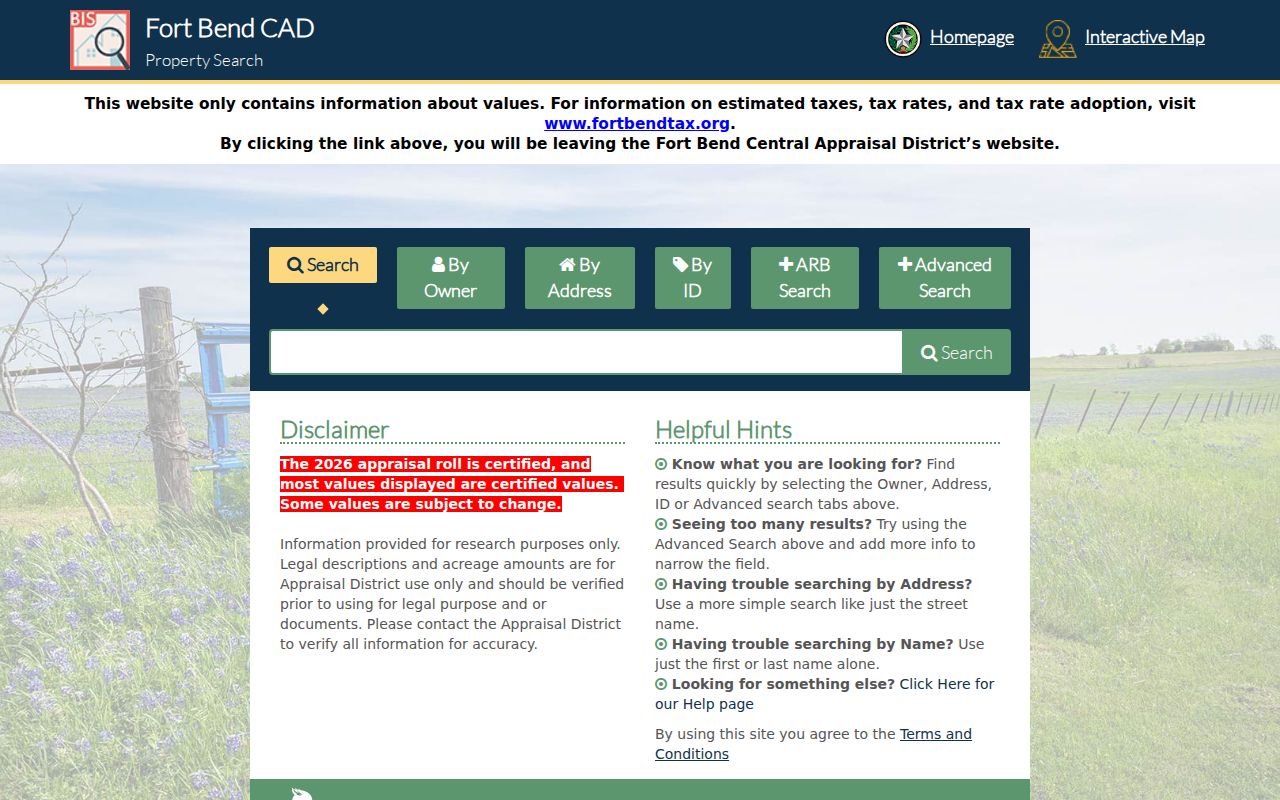
Use an FBCAD result for a Katy parcel to identify the legal-description context, then confirm any recorded transfer through the Fort Bend County Clerk rather than treating the appraisal screen as the deed itself.
Katy Parcel Maps Along a Street
Katy parcel maps help place a Katy address among nearby legal parcels. The HCAD Parcel Viewer accepts a full or partial Katy address, account number, or owner name. After choosing a result, a Katy parcel click opens a popup or detail path. HCAD provides zoom, drag, current-location, and basemap controls. FBCAD's public parcel service supports map extent and attribute work, while Waller CAD links its Interactive Map from the district site. Each map is a Katy context tool for parcels and county lines, not a survey.
Map boundaries are approximate. They can suggest which Katy parcel touches a street or which county source to open next, but they cannot prove a legal boundary, a shared household, or a present personal relationship. Record the Katy map source and date. Then follow the account or property ID back to the Katy appraisal card and, when the question concerns a transfer, to the county clerk's recorded-document index.
Katy Address Records and Coverage
Katy street-level research works because several record series repeat part of the same parcel description. Each series has a different custodian and a narrower purpose. The Katy appraisal card is the practical starting point. The Katy map adds location context. The Katy deed index identifies recorded instruments. A Katy plat translates a legal description into a subdivision and lot relationship. Permits and historic directories can add dated Katy context, but neither changes the legal record held by the county clerk.
| Address-linked record | Katy-area keeper | What it can show | Access route |
|---|---|---|---|
| Katy appraisal parcel card | HCAD, FBCAD, or Waller CAD | Account or parcel ID, owner, mailing and situs addresses, legal description, value, exemptions, and jurisdictions | County owner, address, ID, or advanced portal with tax-year and privacy limits |
| Katy GIS parcel layer | County CAD viewer or service | Parcel polygon, map ID, and adjacent-parcel context | Public map or service, approximate and not a survey |
| Katy recorded deed index | County Clerk | Grantor, grantee, instrument number, date, type, legal description, and lien or easement trail | Party, legal-description, or instrument search; copy access varies |
| Katy plat or subdivision record | County Clerk, archive, or CAD | Lot, block, subdivision, dedication, easement, and street relationship | Follow the legal description; older images can require an office or archive route |
| Katy permit record | City of Katy Civic Access | Permit type, status, application, and inspection history | Public address search has limited fields; fuller functions use an account |
| Katy tax-account record | County tax assessor-collector | Tax-account or payment context | County-specific service route, not title evidence |
| Katy historic directory | UT, TSLAC, HCPL, or archive | Dated address, name, telephone, or household notation | Issue, year, library, or archive access rules apply |
A parcel number can connect the appraisal card to a map or deed-history clue. The legal description is often the stronger bridge into a clerk index because recorded deed systems are commonly organized by parties and instruments, not by a modern street address.
Katy Legal Descriptions Link Streets
When a street search reaches a parcel, save the legal description exactly as shown and compare it to the clerk index or instrument image. A physical address can be changed, formatted differently, or assigned a Katy mailing city outside the incorporated city. A lot, block, subdivision, abstract, or other legal-description element follows the land record more closely. This is why a county result should always be labeled with its tax year and county before it is connected to another record.
- Parcel
- A defined piece of land in the appraisal system, usually tracked by an account or property ID.
- Situs address
- The physical property address used for appraisal purposes. It is separate from a mailing address and does not identify every current occupant.
- Plat
- A recorded map that can show lots, blocks, streets, dedications, and easements within a subdivision.
- Criss-cross directory
- A dated reverse-style directory that may organize entries by address rather than only by name, when that volume includes such a section.
For Katy parcels, this step also prevents a three-county mistake. HCAD, FBCAD, and Waller CAD should be chosen by the parcel county, not by the mailing city displayed on an address line.
Katy Deed Chains by Street
Harris County's real-property records reach from 1836 forward, but older online indexing has limits. Start its search with the appraisal account, current owner-of-record field, and legal description. The Harris County Clerk Real Property Records page is the proper county source for the resulting deed search and copy options. For older material, the Clerk's pre-1961 indexing difficulty can mean a counter, archive, microfilm, mail, fax, or email copy-request route is needed. A current parcel result does not erase that historical access gap.
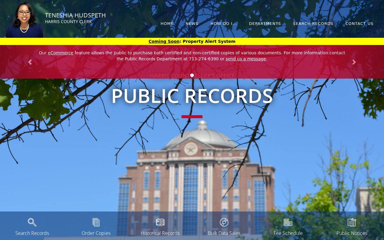
The Harris landing page is a useful starting point for recorded-property research, while the legal description and instrument details from the parcel remain the safeguards against a same-name error.
Fort Bend's Official Public Records index contains deeds, mortgages, easements, liens, powers of attorney, bills of sale, and related instruments. It has a historic online library reaching into the 1820s by series, although exact coverage depends on the record type. The index is not address-first. Use the FBCAD parcel result to supply a grantee name or legal description, then compare the image or certified record with the county's held record. Waller requires a different caution: an official online land-record portal was not verified in the research, so a Waller CAD page is not a substitute for a recorded deed.
The Fort Bend County Clerk official records search describes the portal and its recorded-document categories.
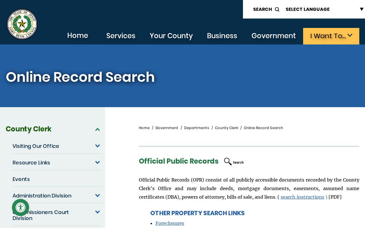
Use the document type, recording date, instrument number, grantor, and grantee together. A result without those anchors is only a lead, not a complete chain of title.
Katy Permits by Address
City of Katy permit information is a separate municipal record series. The current Katy permits and building page directs users to Civic Access, where public search, account-based plans, payment, status, and inspection functions are described. Public results can be limited. An address hit may help identify a permit number, type, date, status, or inspection history, but it does not determine parcel title and should not be used to infer a current household.
For a record not exposed in the public view, request the existing municipal file by address, date range, or permit number through the Texas Public Information Act route. Ask for a specific existing record and the releasable portions. County clerk instruments, CAD facts, and city permit files belong to different custodians, even when they all refer to the same Katy address.
Katy Historic Address Directories
Historic directory evidence is dated evidence. The strongest confirmed regional lead is the Richmond Telephone Directory at the University of Texas, which includes Katy alongside Richmond, Rosenberg, Fulshear, and Sugar Land. Inspected issues span from 1918 into 2005 with gaps. It should be described as regional telephone-directory coverage, not as a dedicated Katy city directory. A result should retain its issue date, page, title, and the spelling printed in that volume before it is compared with deeds, parcels, newspapers, or census material.
The Texas State Library and Archives Commission provides city-directory research in its Austin Reading Room and links to catalog resources. Staff do not conduct remote telephone searches, transcriptions, or emailed scans. Harris County Archives also identifies Katy branch material, photographs, and a Katy town file in its finding aids, while HCPL offers local genealogy and history resources. For directory years, collection locations, and reading-room details, use the Katy city directories collection rather than treating a historical address as a present-day resident result.
Katy Street Records in Three Counties
Katy's county geography is the local fact that changes every street-directory search. Harris, Fort Bend, and Waller clerks keep different record series, online coverage, office procedures, and historical fallbacks. Harris has the known pre-1961 indexing gap. Fort Bend provides a historic online library and a County Clerk branch at 22333 Grand Corner Drive in Katy for recording, copies, and research services. Waller CAD is the readily found property portal, but the exact official Waller County Clerk land-search address was not confirmed in the source review.
When a Waller result needs an older instrument, use the clerk's current counter or request route and the Texas State Library and Archives Commission's Waller microfilm catalog rather than guessing at a web index. The catalog identifies historical county-court minutes, transcribed deeds, and deed records by series and reel. This three-way decision tree is more accurate than treating every Katy mailing address as a Harris or Fort Bend record.
Katy Street Directory Limits
A public street-record chain does not create a complete live address list. A tax owner, a mailing recipient, a recorded grantee, and a person physically present can be different people. Utility customers, motor-vehicle personal information, protected voter addresses, sealed matters, and many household details are not a public street roster. Texas voter tools are individual lookups with required matching details, not a browse-by-street feature. A protected voter display marked with a substitute address must never be reconstructed from parcel or deed records.
Lawful use. Katy address records are for personal, lawful research such as family history, estate questions, civic review, and property documentation. Do not use a record trail to stalk, harass, intimidate, or expose a protected address.
For city-held information that is not public online, request the specific existing record from the proper custodian. Under Texas Government Code Chapter 552, an agency generally must promptly produce public information or explain an exception or Attorney General review. Redactions and confidentiality programs are limits to respect, not gaps to work around.