
Katy ZIP Code Coverage
Katy postal geography needs a Katy address-level check. Official Katy material associates six local postal ZIPs with Katy areas or communities, while two more entries are useful Greater Katy context. USPS delivery areas do not follow municipal boundaries or county lines. The table keeps the published descriptions narrow because an exact delivery station or a neighborhood boundary was not captured for every entry. Use the Katy address lookup before assigning a station, city jurisdiction, or Katy county record path.
| ZIP | Areas covered in inspected sources | Post office | Records note |
|---|---|---|---|
| 77449 | Katy-area postal community, principally north and east Greater Katy | USPS Katy service; confirm station by exact address | Large delivery area, not equivalent to Katy city limits |
| 77450 | Katy-area postal community west and south of the core | USPS Katy service; confirm station by exact address | Postal area can include addresses outside the incorporated city |
| 77491 | Katy postal designation in archived USPS locality material | USPS Katy service; station detail not captured | Confirm current use and address-level delivery status |
| 77492 | Katy postal designation in archived USPS locality material | USPS Katy service; station detail not captured | Verify any PO Box or Greater Katy association with USPS |
| 77493 | Core Katy postal community and common city postal ZIP | USPS Katy service; station detail not captured | City map and MUD source still control jurisdiction questions |
| 77494 | Katy and Fort Bend postal community, including Cinco Ranch and Grand Corner vicinity | USPS Katy service; station detail not captured | Fort Bend district material uses a Katy Gap Road example |
| 77363 | Waller County postal-community entry for Katy | USPS rural or area service; station detail not captured | Greater Katy and Waller clue, not incorporated-Katy proof |
| 77094 | Greater Katy and Houston-edge mailing association in local guidance | USPS address lookup required | Not labeled a Katy-city ZIP without exact-address verification |
The source review did not capture an official current ZIP-to-neighborhood boundary map, a split history, or a per-ZIP count of residents. That absence makes precise USPS output and the county parcel source more useful than a broad neighborhood label.
Katy ZIP Code Delivery Areas
The USPS postal lookup for Katy offers three relevant modes: By Address, By City and State, and Cities by ZIP. By Address accepts street and city or a street plus ZIP, with an optional organization field. Use its standardized Katy street, city, state, and delivery output as the first spelling check. USPS specifically warns that a result does not confirm a person or organization at an address. It is a delivery tool for Katy addresses, not a resident record or a municipal map.
USPS also explains that address changes can take 30 to 60 days to appear. Retain the date of the lookup when a new Katy street, subdivision, or address form seems inconsistent with a Katy county record. A Katy mailing-city result may say Katy even if the parcel is unincorporated, in another municipality, or under a different county office. The city name printed on an envelope is therefore not a substitute for the county appraisal result or the official Katy city-boundary source.
Katy ZIP Code Search Fields
HCAD Advanced Search is the local parcel portal for Katy parcels with a documented five-digit ZIP field. It can combine that filter with street-name and beginning or ending street-number fields, then return Katy parcel research leads for the selected tax year. HCAD Quick Search also offers Account, Address, and Owner modes for Katy searches. FBCAD provides Owner, Address, ID, and Advanced tabs for Katy's Fort Bend parcels, but the captured research did not verify a ZIP control there. Waller CAD's captured Advanced inventory likewise did not show a ZIP field for Katy's Waller parcels. A ZIP-only result must still be narrowed to its parcel county and legal description.
| HCAD field | Input form | Use for ZIP research | Limit |
|---|---|---|---|
| Tax Year | Dropdown | Sets the appraisal-record year before searching | Available choices are dynamic |
| ZIP Code | Five-digit text | Narrows an Advanced Search to a delivery-area filter | Does not establish a municipal boundary |
| Street Name | Text | Refines a broad ZIP result | Prefix, suffix, and similar-name settings affect matches |
| Beginning and Ending Street No. | Text | Targets a portion of a street inside the filter | Use exact values or a supported range |
| Legal Description | Text | Confirms subdivision or parcel context after a result | Not a delivery-address field |
| Owner Name | Text | Checks the appraisal owner field for a selected parcel | Owner and mailing fields do not prove occupancy |
The Fort Bend Central Appraisal District property search is the appropriate parcel path once an address is known to be in Fort Bend County.
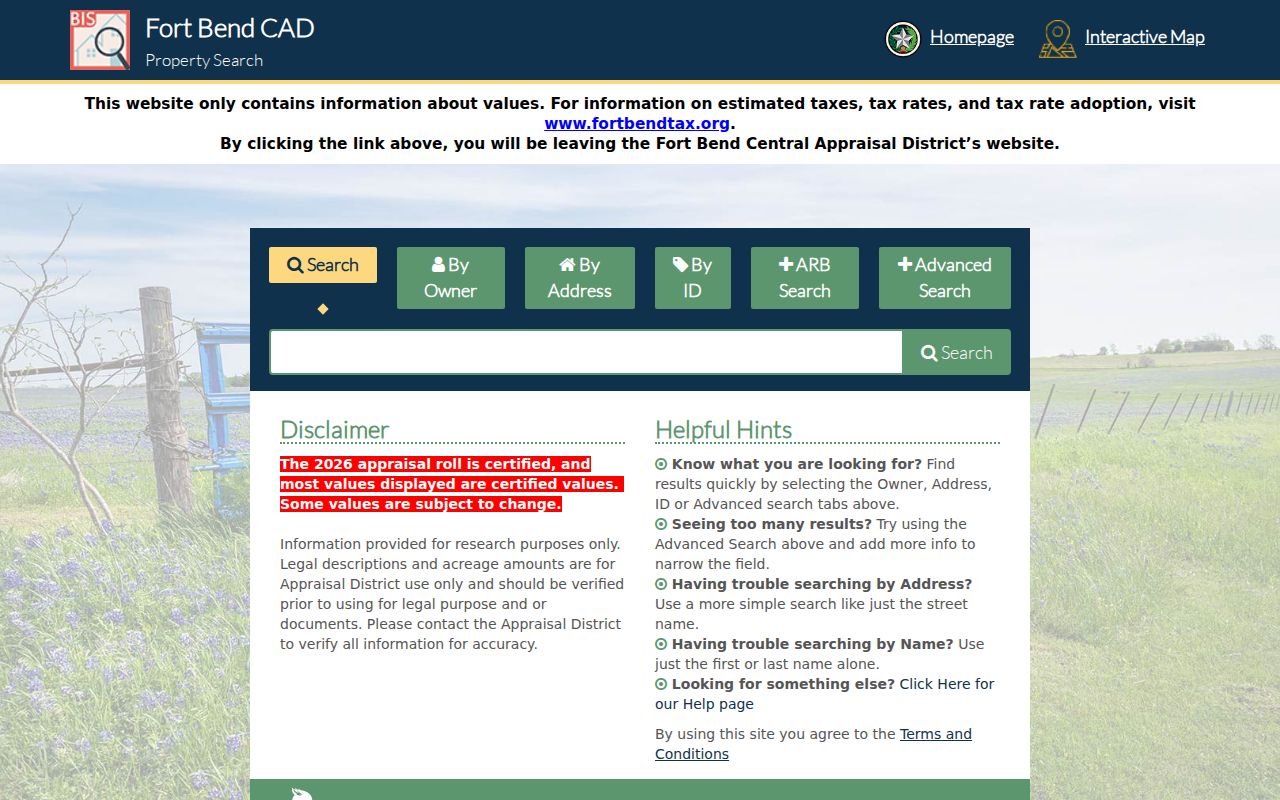
Its Owner, Address, ID, and Advanced tabs support parcel research after the county decision. Compare the returned legal description and tax-year labels with the clerk's recorded instruments when the question concerns a transfer.
Search Katy Records by ZIP
A Katy ZIP filter is most useful when it narrows a Katy parcel search without pretending that it is a person list. The postal result establishes a delivery format. The county CAD establishes the parcel branch. The Katy city boundary or MUD context distinguishes jurisdiction. Once a specific address remains, the Katy legal description and recorded-instrument route become more reliable than a broad postal filter.
- Run the full Katy address through USPS and retain the standardized delivery result and lookup date.
- Use the five-digit HCAD Advanced Search field for a Katy Harris parcel, then refine with a street name or street-number range.
- For a Katy parcel in Fort Bend or Waller, use the official address or advanced portal after confirming the county. The captured research does not establish a ZIP-wide control for those portals.
- Compare the parcel county with the City of Katy map, MUD material, or Comprehensive Plan context. Postal city, municipal jurisdiction, and parcel county should remain separate labels.
- Use the county clerk's deed index only after the parcel supplies a name or legal description. For a street-level chain after the ZIP is narrowed, use the Katy street directory.
Texas My Voter can return a matching individual's registration context when its required fields are supplied, but it is not a ZIP-wide public roster. Fort Bend street-range and district material can include ZIP examples, yet it is a district-assignment aid rather than a list of people.
Katy County Checks by ZIP
Katy is a three-county city, and a Katy postal line can reach Harris, Fort Bend, or Waller records. This records geography is the main local reason not to choose an office from a ZIP alone. HCAD, FBCAD, and Waller CAD each search their own parcels. Their results then point to different county clerks, court systems, tax services, and historical fallbacks. A postal community can cross into unincorporated areas or nearby municipalities while retaining the same mailing city.
Start with the situs address and parcel county. Harris County Clerk real-property records run from 1836 forward, with a known pre-1961 online-indexing difficulty. Fort Bend County Clerk has a historic online library whose coverage reaches into the 1820s by series and a Katy branch for records services. The exact Waller County Clerk online land-record portal was not verified, so a Waller CAD result should lead to the current clerk counter, request route, or Texas State Library and Archives Commission microfilm catalog, not an assumed online deed search.
Note: A county appraisal result identifies a parcel-research branch, while USPS, city-boundary, and clerk records answer separate questions about the same address.
Katy ZIPs and City Limits
ZIP boundaries and Katy city limits are not the same boundary. The City of Katy map and Comprehensive Plan place the city at the meeting area of Harris, Fort Bend, and Waller counties. The city MUD information gives the key warning: a Katy mailing address does not mean an address is within city limits. An address can carry a Katy postal city while it is outside the incorporated city, in a nearby municipality, or served by a county or municipal utility district. The 2024 Census BAS map supplies statistical-boundary context, but it is not a title survey.
For a precise local record trail, display three separate values: postal city, municipal jurisdiction, and parcel county. Use the official Katy city map for orientation, the appraisal record for parcel context, and the clerk for recorded instruments. The Comprehensive Plan was adopted March 27, 2023, so its growth and ETJ maps are dated planning context rather than a live parcel register.
Katy Postal Definitions
Postal terms are easy to overread in an address search. They describe how mail is sorted and delivered, not a title, boundary, or personal-identity finding. Keep the terms below beside the source date and the exact address that was checked.
- ZIP versus ZIP+4
- A five-digit ZIP identifies a delivery area. ZIP+4 adds a delivery segment, such as a small group of addresses, and does not confirm a person or municipal boundary.
- PO Box ZIP
- A ZIP used for post-office boxes can share a postal association with an area without describing a physical-property location.
- Unique ZIP
- A ZIP assigned for one organization or delivery purpose. No Katy-specific unique ZIP was verified in the research, so do not infer one from a mailing label.
- Carrier route
- A postal delivery grouping used for mail handling. It is not a record of everyone connected with the addresses on that route.
Katy ZIP Directory Limits
A postal result cannot confirm a person, organization, current household, parcel owner, or city residence. HCAD's ZIP field can narrow an appraisal search, but HCAD says its records are not a title determination. FBCAD and Waller CAD likewise provide appraisal and parcel context, not a live address roster. The right next step is the source that fits the question: a county clerk instrument for a recorded transfer, a city record for a public municipal file, or a dated directory for historical address context.
Privacy limit. A protected voter display, confidential address, sealed record, or redacted CAD field must remain protected. Do not combine postal, parcel, or map data to reconstruct withheld personal information.
Texas election guidance treats some voter identifiers and contact details as confidential, and protected voters may use a substitute address. The state lookup returns a current matching result, not a public list sorted by postal area. If an official record is not open through its normal portal, use the lawful custodian request channel rather than attempting to bypass a redaction.
Katy Postal Records Change
Keep a short research log for each address: the USPS lookup date, displayed postal city and ZIP, appraisal district used, tax year, parcel or account ID, city-limit source, and clerk index date. That log makes it clear why an address with a Katy mailing line may produce a Harris, Fort Bend, or Waller record. It also preserves the difference between a delivery update and a land-record change.
When an online index stops, the fallback depends on the county and record type. Harris may require its archive, microfilm, or copy-request channels for older indexing. Fort Bend's historic library coverage varies by series, and its Clerk branch offers local records service. Waller historical county records are cataloged on TSLAC microfilm. Those access paths are more dependable than making a boundary or ownership claim from an old postal listing.